Saturday 24 December 2016

Merry Christmas (Eve)


So, this is my final blog post for this module. This has probably been one of the most challenging university projects, in being consistent at producing weekly blog posts for two different modules. However, it has been one of the most interesting and engaging projects I have completed to date.

Throughout this blog I have examined the hydrological impacts that have already and will occur in East Africa due to climate change. I have also reviewed this in the context on land use change. What is important to note is that climate change is not a future phenomenon, it has been occurring for many decades.  What has been particularly interesting is that East Africa is an extremely diverse region, with different areas experiencing varying hydrological impacts. Therefore, there is a fundamental need to focus on regional and local aspects of climate change.

Climate change is not only changing the frequency of extreme weather events, but also seasonality, intensity and duration. During the coming century, increasing population, changing pattern of water use, and concentration of population and economic activities will pressurise Africa's water supply. Therefore, adaptive and mitigation strategies, both institutional and local are needed to be employed to reduce vulnerabilities, and allow this continent to flourish and develop more proportionally.


Remember in a warming world, not all Africa's taps will run dry.

Saturday 17 December 2016

Rift Valley Fever


What is Rift Valley Fever?

Rift Valley Fever (RVF) is a virus transmitted by mosquitoes and blood feeding flies that usually affects animals but also affects humans. The virus was first identified in 1931 during an epidemic among sheep. Since then outbreaks have been reported in SSA, North Africa, and in 2000 Saudi Arabia and Yemen.

The occurrence of RVF is known to follow periods of widespread and heavy rainfall associated with the development of strong ITCZ. Heavy rainfall floods mosquito breeding habitats, known as "dambos" in East Africa, providing an ideal environment for naturally infected mosquito eggs to hatch (Figure 1)/


Figure 1: Rift Valley Fever Ecology

In 2006-2007, outbreaks in Kenya, Somalia, Tanzania, Sudan, and Madagascar caused > 200,000 human infections and led to roughly 500 deaths. In Kenya alone, the outbreak cost $32 million in livestock losses and international export bans. An outbreak in 1997 caused 170 haemorrhagic fever associated deaths and ~27,500 infections. The most serious outbreak on record occurred in Kenya 1950-51, and resulted in the death ~100,000 sheep (Greenhalgh, 2015).

Predicting outbreaks

Enso is recognised to be linked with outbreaks of RVF in East Africa. 2015 stood out to be one of the top three El Nino events since 1950, Sudan, Ethiopia, Somalia, Kenya and Tanzania were identified as areas at risk for RVF due to substantially elevated rainfall (figure 2)


Figure 2: 2015 projections of extreme rainfall and RVF outbreaks


Climate Change


More extreme rainfall events are projected in East Africa with warmer temperatures. These events will create the necessary conditions for more RVF outbreaks not only in East Africa, but also potential for it to expand its geographical range (Martin, 2008)

Future projections

A study 'Environmental Change and Rift Valley fever in eastern Africa: Projecting Beyond Healthy Futures', focussed on the Republics of Burundi, Kenya, Rwanda, Uganda and Tanzania. The two pathway scenarios RCP4.5 and RCP8.5, indicate increased temperatures, rainfall and variability. Results highlight high- risk of future RVF outbreaks, including parts of East Africa that are currently unaffected. The results also highlight the risk of spread from/ to the study area, and possibly further afield. The greatest projected changes in RVF outbreaks are in Kenya and Tanzania. Changes remain stable up to 2050, when compared with baseline results, even declining in central/ eastern Uganda (RCP4.5), before increasing by the end of the century. Positive changes are most evident to the West of Lake Victoria (Berundi, Rwanda and Western Uganda) and in Western Kenya, especially under RCP8.5 by the end of the century.

The study also combined results of a spatial assessment of social vulnerability to the disease in Eastern Africa. Predisposition to RVF is greatest where the boarder of North-eastern Uganda, North-western Kenya and South Sudan meet, because of the co-occurrence of highly seasonal rainfall, relatively high densities of livestock, high levels of poverty and poor infrastructure, including health services. Under RCP4.5 risk decreases in Southern and Central Uganda, however increases in Central Kenya. For RCP8.5 risk patterns are similar however, RVF has expanded again in central and Southern Uganda, and is greater in Western Kenya.

Results show that with increasing extreme precipitation events, there is a clear need to remain vigilant and to invest not only in early warning systems, but also in addressing the socio-economic factors that underpin social vulnerability in order to effectively mitigate future impacts (Taylor, 2016).

Saturday 10 December 2016

Land use change as important as climate change

Throughout this blog, I have vaguely touched upon land use change. However, this too, is an important factor affecting the hydrological system in East Africa.

As shown in previous posts, agriculture largely contributes to the East African economy. Although a very risky enterprise due to increasing rainfall variability, many East African farmers have adapted to their variable climate in very successful ways- this is often results in the modification of land- cover and/ or land- use type. These effects have shown to have significant impacts on rainfall, as well as GHG effects (Moore, 2015).

Land- use change and drivers


Some of the main land use conversions in East Africa can be summarised as:

  1. An expansion of cropping into grazing areas, esp. in semi- arid to sub- human areas
  2. An expansion of rainfed and irrigated agriculture in wetlands or along streams esp. in semi- arid areas
  3. A reduction in size of many woodlands and forests on land that is not protected
  4. An intensification of land use in areas already under crops in the more humid areas
  5. the maintenance of natural vegetation in most protected areas
What are the drivers of land use change in East Africa?

  1. Government policy, laws and regulations 
  2. Economic factors
  3. Population growth and migration
  4. changes in land tenure arrangements
  5. Access to markers
  6. Environmental conditions

Land use and climate change 

In a study 'projected land- cover change effects on East African Rainfall under climate change', Moore (2015), examines the regional responses to GHGs, Landcover/ land use change (LCLUC), and their combined effects in East Africa. The aim was to further understand how hydrological mechanisms might be altered by LCLUC in future scenarios. The four different scenarios they used were:
  1. Current land- cover and current climate
  2. current land- cover and future climate
  3. Future land- cover and current climate 
  4. Future land-cover and future climate

It found that LCLUC can affect precipitation in several ways:
  • Increase in albedo from the change in land cover from forest to crop lands, can result in surface cooling, which can reduce convective rainfall.
  • An increase in the amount of suspended dust from overgrazing which removes large amounts of vegetation. This can result in radiative cooling, and therefore a decline in (convective) precipitation.
  • Intensive rainfall is also caused by LCLUC due to an increase in intensive convection. These convection changes can enhance the local sea breeze effect. As shown previously, East Africa is already and will face more extreme weather events due to increased GHGs. LCLUC has the potential to increase the risk to floods and damage to agriculture in coastal areas where forest has been replaced with agriculture.
Results show that GHG and LCLUC may slightly differ in how they alter regional precipitation patterns. One of the most important findings is that projected precipitation changes around major populated areas may be as strongly influenced by LCLUC and as by GHG effects. Precipitation in areas which have a large population density were more influenced by LCLUC than GHG, due to higher human and agricultural systems. GHG effects on precipitation, largely has wide scale implications, whereas LCLUC have more regional and local impacts.

This paper has shown that Climate change and land use change are not two separate forces affecting the distribution of precipitation; instead they are interrelated. Figure 1 clearly depicts this.

Figure 1: framework of land use/ cover linkages and flow dynamics among driving forces, bio-physical system, and climate change

Impacts on river basins

What are the impacts on river basins? A study on the Mara River Basin, Kenya found that any further conversion of forests to agriculture and grassland in the basin headwaters is likely to reduce dry season flows and increase peak flows, leading to greater water scarcity at critical times of the year and exacerbating erosion on hillslopes.
     
      Most projections call for precipitation increase of 5-10% in this century. This can suggest greater future availability of water resources in this basin. However, results from this study conclude that together with increases in evapotranspiration (from warmer temperatures) and potential increases in aquifer recharge, runoff will be limited. Water balance showed non- linear responses to climate change. Small decreases precipitation may produce large reduction in runoff because of reduced runoff and increased evaporation.

Therefore, model results support protecting headwater forests and indicate that additional emphasis should be placed on improving land management practices that enhance infiltration and aquifer recharge as a part of a wider program of climate change adaptation.

Concluding thoughts

This post has shown that land use change does have a large influences over change in precipitation. Although, these may be localised in comparison to climate change, they should be incorporated into rainfall projections, as well as mitigation and adaptation strategies. 

r

Saturday 3 December 2016

COP22

World Climate Simulation


Last week as part of my Global Environmental change module, we took part in the world climate simulation. As part of this, we had to act as a negotiator at the united Nations Climate Change negotiations. I was part of a team of 4 acting as delegates from the united States. In the 3 hours, teams from each region had to negotiate to try and get temperatures down to 1.5℃. We managed 2.1℃. It showed how challenging it can be to reach agreement between different regions, how complicated politics can be and how tensions can rise very quickly. 

The exercise is framed by current climate change science, using the interactive C-ROADS computer simulation which allows participants to find out how their proposed policies impact the global climate system in real- time. We went into this not really knowing how COP (Conference of the parties of the United nations agreement on climate change) worked, and we left with so much more knowledge and understanding.

I would definitely encourage students (not only geography), schools, lecturers, businesses, leaders, everyone to get involved. Below is a video of how this climate simulation works:


Mock video of how the world climate simulation works


But what does this have to do with Water and Environmental change in Africa?


COP22 was held in Marrakesh 7-18th November 2016. For the first time in history, a water action day was the highlight of the third day. World Water Action day aimed to highlight the water sector as a provider of solutions for implementing the Paris Agreement (COP21). 

Countries have identified water as key to adaptation in 93% of their national climate action plans. Water is the key to food security, human health, energy production, industrial productivity, biodiversity, as well as a basic human need. Therefore, ensuring water security means ensuring security in all these domains.


From the Water Action Day, "Water for Africa" was officially launched. This initiative aims to mobilise different international political, financial and institutional partners to develop an emergency action plan to confront climate change and improve water and sanitation services and management in Africa.


Concluding thoughts


Water needs to be seen as an end in itself, rather than merely a means to an end.

The importance of water seems to be highlighted through its critical role in other domains. It is a start that the sheer importance of water is now being acknowledged on the platform of COP, through the action day. However, I believe more needs to be done, to bring to the attention, that climate change is drastically changing the distributions of water, and this has already and will have many negative implications for many. Long droughts and extreme rainfall, are becoming common for many, so how can this is increasingly unreliable resource be the solution for all the problems arising from Climate Change? 

Africa is the most vulnerable to climate change. Therefore, effective funding and management is necessary, to adapt to the threat of climate change. The $100bn per year promised to be pledged by the developed countries by 2020 in Copenhagen 2009, could be key to this. Although by the end of COP22, there is said be 'extreme disappointment' in the lack of progress in agreement to the distribution of the funding, which has been pushed back to 2018.


Adaptation is key to the survival and development of Africa. A roadmap drawn up by developed countries and presented at Marrakesh allocated just 20% of climate finance, to efforts limiting the damage caused by climate change. The remaining 80% of this money would be spent on mitigation (cutting greenhouse gas emissions). However, I believe that this is an unfair distribution, as the need for adaptation is particularly important in developing countries, which are hit hardest by climate hazards such as droughts and floods.

Throughout this blog I have illustrated through East Africa that water supply is changing and is becoming extremely unreliable. However, this is not the only issue, demand is also changing, it is increasing. One effect of this is changes in land-use. Therefore, next week's post will focus on land use change, and how this, in conjunction with climate change, is affecting Water in Africa.

Saturday 26 November 2016

GroundWater potential in East Africa

Groundwater

Groundwater is the most abundant and readily available source of freshwater, and in fact accounts for > 90% of accessible freshwater worldwide (Figure 1). The abundance of groundwater is largely influenced by climate variability and change through replenishment by recharge, and indirectly through groundwater use. These impacts can be modified by human activity such as land-use change (Taylor, 2012).


Figure 1: Groundwater storage for Africa based on the effective porosity and saturated aquifer thickness

Potential for ground Water recharge

A shift towards few but heavier rainfall events is expected due to climate change in the East African region, this is expected to lead to more frequent and intense floods as well as variable and lower soil moisture. 

Based on records from the Makuyapora Wellfield, Tanzania 1955- 2010, Taylor (2013) finds that groundwater levels have been declining due to over abstraction. People have been removing water from the deep granite aquifer to provide water to the capital. Abstraction has increased from 0.1million mto 0.9million mper month in this time period, however supplies have not. This appears to be because episodic recharge events are sustaining intense abstraction.

Figure 2: Analysis of the relationship between groundwater recharge and rainfall


As shown in figure 2, for a large proportion of the record, there is no recharge. Recharge only occurs when there is highly intense seasonal rainfall. Recharge results disproportionately from > the 80th percentile. A non- linear relationship between rainfall and recharge is demonstrated, where intense seasonal rainfall associated with ENSO and the IOD contributes disproportionately to recharge. 

Taylor (2013), shows that projected intensification of rainfall under climate change may favour recharge. Therefore, in a warmer world, where we see more intense rainfall events, groundwater may be a viable adaptation to support longer droughts and lower soil moisture. However, there are many problems that arise.


Problems


Uncertainties

Long- term monitoring data is generally lacking across the East African region, and in cases where data is available, there is more often than not, inconsistencies due to varying methodologies used. This can make comparisons and identifying trends challenging (Comte, 2016). One key uncertainty is whether soil infiltration capacities will be able to transmit heavy rainfall, and therefore actually generate increases in groundwater recharge as the models show (Taylor, 2013). There is also uncertainties of whether increased rates of potential evapotranspiration from warmer air temperatures will induce groundwater recharge (Kingston, 2009). A very important uncertainty, lies in the assumption that all increasing intensive rainfalls will contribute equally to groundwater recharge. 


Barriers to development 

Socio- economic and political factors can cause groundwater development costs to be higher than they would otherwise. According to Giordano (2006) the typical reasons for this include lack of local manufacturing capability, high duties on imported equipment, high energy costs, and poor supporting infrastructure such as road networks and electricians.

Furthermore, in some cases there has been national and donor policy that has undermined groundwater development. The push by donors and governments to invest in large scale irrigation schemes for example dams, may have drawn financial capital away from groundwater development. Furthermore the numerous large scale schemes that have failed in the past, may turn 'farmer sentiment away from irrigation expansion' (Giordano, 2006).

Influences on supply

Changes in total volume in precipitation largely influences the supply of Groundwater.

The recharge of groundwater due to climate change can also be affected by other influences such as over abstraction and land- use change. Increasing demand due to population growth and economic development, can lead to an increase in the use of groundwater supplies. If demand outstrips supply, these resources will be depleted.  (Carter, 2009).

At the continent level East Africa has the second highest rate of population growth. In contrast to inland areas where abstraction is only limited by aquifer productivity and available recharge. Coastal aquifers are susceptible to seawater intrusion, if not managed carefully due to being low- lying and shallow water tables. Salt water intrusion is already a risk to groundwater supplies if over abstracted, however, it is higher in coastal regions.

The combination of increasing rainfall extremity, increase in sea level rise (cause saltwater intrusion), increased urbanisation (results in increased surface runoff from land clearance), and increased demand for water (increased abstraction), puts coastal regions of East Africa at risk. All these factors have already, but will have further negative implications on groundwater recharge. Although recharge is projected to increase with climate change, fresh groundwater availability will likely decrease in coastal areas if an effective management regime, involving communities is not introduced (Comte, 2016).


Hydropolitical issues 

There is an issue that aquifers may be transboundary, this creates hydropolitical issues (Taylor, 2009).  A transboundary aquifer is a body of groundwater which is intersected by two or more countries with the potential threat of dispute over shared groundwater resources. Abiye (2010) examined the transboundary aquifers in 6 East African countries (Ethiopia, Eritrea, Sudan, Kenya, Somalia and Djibouti). Although these countries are yet to give major attention to the groundwater contained in these transboundary aquifers, the author stresses the need for a change. They state the future trend is steering towards increased exploitation of these reserves due to water shortages. Therefore, systematic development of these resources is needed to strengthen cooperation, and reduce the potential for conflict.

Concluding thoughts


Through increased recharge from more intense rainfall events, Groundwater can enhance the resilience of domestic, agricultural and industrial uses of freshwater in the face of increasing climate variability and change. There are many issues that arise especially from increased population growth and economic development, that puts groundwater resources at risk from over abstraction, salt water intrusion and pollution. There is also the potential for conflict over transboundary resources. Therefore, for groundwater to be sustainably seen as a solution, it needs to be integrated into national policy and requires development of adequate cross- sector dialogue within government, as well as enhancing communities in the management process.

Saturday 19 November 2016

Irrigation in Kenya


Coefficient of Variation (c.v)


In last week's post i mentioned the C.V in order to describe the seasonal variability of rainfall in regards to Maize Farming.  

C.V is the formal definition of intra-annual or seasonal variability defined through 'normalised' spread of average rainfall over the year.  The CV is the average of 12 monthly rainfall values for a country (k) defined as CVMk = σ(Pj,k)/μ(Pj,k); i.e. as the ratio of standard deviation of calendar month (j) average rainfall to its grand mean across all calendar months (Brown, 2006).

Climate change is increasing rainfall variability, and is therefore making conditions for agriculture and economic development very difficult (Brown, 2006). Greater rainfall variability highlights a greater need for irrigation. It brings to attention the areas that may need supplementary irrigation to 'regularise' crop yields (Challinor, 2006). CV therefore enables solutions to increase reliance to these changes to be put in place, and therefore mitigate some of the expected impacts of climate change (Brown, 2006).


Irrigation in Kenya

Agriculture is the leading sector in the Kenyan economy, contributing to 24% of GDP, and is the largest contributor to employment (with > 70% of the labour force based in rural areas), and accounts for about 50% of principal export earnings (Kabubo- Mariaria, 2007).

In Kenya, traditional irrigation dates back 400 years, which is longer than most countries in Eastern and southern Africa. According to the Fao, in terms of utilising low- cost technologies (including rainwater harvesting, bucket irrigation, gravity fed sprinkles and drip, treadle and pedal pumps, rope and washer, mortised pumps, wind power and construction of small earthen dams), Kenya is well ahead of other countries in the sub- region.

Irrigated lands are up to 2.5 times more productive in comparison to rain-fed agriculture. They play an important role in the agricultural sector in SSA, and are often favoured by governments and donor agencies for their high return rate.

Models predict that global warming will lead to increased temperatures ~4℃ and rainfall variability up to 20% by 2100. Using Ricardian analysis, a study on the economic impact of climate change on Kenyan Agriculture, shows that climate does affect agricultural activity. They show that adaptation to climate change in Kenya is important, if households want to counter the impacts of long- term climate change. Results of perceptions and adaptation of farmers to climate change showed that Kenyan's are aware of both the long and short term changes in climate and have implemented various adaptation mechanisms. They do show that coping strategies must be tailored specifically to different factors including physical, economic and sociocultural. They found that irrigation is adopted in the drier regions, but not the areas that have a high potential for evaporation, in which the most common adaptation measure is diversification.


Some of the types of irrigated agriculture found in Kenya are:

  • Large- scale surface irrigation schemes by the Government, in which smallholder farmers play a very small role in management.
  • Smallholder irrigation, either by individuals or small groups, that have been able to exploit water in streams and irrigate small areas in valley floors. This is mainly subsistence, but also cash crops for local markets.
  • Agro-industrial irrigation of high- value crops, finance and developed by private corporations or individuals. These rely heavily on pump- based technologies in conjunction with drip or sprinkler irrigation.

Irrigation potential 

However, Kenya is still heavily dependent on rain-fed agriculture. With 17% of the land considered to have medium to high potential for irrigation, less than 10% is utilised, which amounts to only 2% of total arable land in Kenya (FAO, 2005).

A study on the potential for irrigation in Kenya, has showed that there is high potential for the expansion of both dam-based (water stored in large reservoirs) and small- scale irrigation (surface runoff based) in Kenya. The analysis of the potential investment for Small- scale irrigation project expansion in Kenya ranges from 54,000 ha to 241, 000 ha, with an internal return rate of 17-32%. For the dam- based investment analysis, under low- cost assumption, 58/ 73 damn are profitable. At high cost level, 32 of these dams are economically feasible.

Irrigation does not come without its environmental problems. For example, development of irrigation systems can increase the salinity of cultivated land in the area- this affects 29% of irrigated land in Kenya (FA0, 1997). The main challenges however facing irrigation expansion in Kenya is the cost of implementing projects. Kenya's agriculture sector (75%) is dominated by small- scale farmers, who do not have the capacity to invest in gravity- led or pump- fed irrigation canals (You, 2014). The problem found with large scale irrigation projects, is that often government and donor interests come first before smaller famers. The capacity for governments to manage these systems effectively has often collapsed.


Concluding thoughts

There is potential for both small and large scale irrigation schemes. However, for this to be effective, there needs to be better management and incentives to small scale farmers like subsidies, so that they can invest in technology.

Increasing variability in rainfall, is seeing exceptional high rates of precipitation, which may lead to groundwater recharge which can be harnessed during dry periods. However, the decrease/ lack of precipitation in the dry periods and increased demand may not only lead to decreases in runoff and streamflow downstream, but may also deplete groundwater supplies. As this post never explored groundwater as a source of water for irrigation, next week's post will look closely at the Groundwater potential in East Africa.


Saturday 12 November 2016

Maize Farmers in Tanzania

Rainfall Variability


The most important factor in sustaining crop productivity is water availability. Rainfall variability from season to season largely impacts soil water availability to crops, and therefore face crop production risks. Ideally, crop cultivations should be situated in areas with high rainfall and low variability. However, as shown in figure 1, in SSA about 37% of maize- growing areas are located in areas where there is high seasonal rainfall variability- coefficient of variation (C.V.) >0.2 (HarvestChoice, 2010).


Figure 1: Map of sub- Saharan Africa showing the coefficient of variation (C.V.) of seasonal rainfall at major maize growing areas during 1955-2004.


As shown in the previous posts, with climate change will come increased rainfall variability, and this will have further implications for Maize farmers.

Maize in Tanzania

In Tanzania, up to 95% of food production depends on rainfall, which is highly affected by climate variability, and this will likely change due to global warming (Sixbert, 2016).  In Tanzania Maize is the 'staple food'. According to the (FAO, 2015), 80% of maize in Tanzania is produced by small-scale farmers and is usually grown under low input, rain-fed conditions. Maize is grown for both substance (65-80%) and cash crop (20-35%).

Hai District 


In a study on the 'Decline in maize and Beans production in the face of climate change at Hai District in Kilimanjaro Region, Tanzania', it was found in the Hai district that in the non- drought years, Maize has the highest yield in comparison to other crops (Figure 2). However, in the years 2003 and 2009- where there was lower annual rainfall- almost 98% of maize crops failed, but the same extreme impact was not felt in low rainfall years of 2005 and 2007.  The study found that there is a strong and significant association between climate change and high variability in yield patterns of maize in the Hai District. The reductions in maize yield are primarily due not only to the increases in temperature and decreases in rainfall amount, but also the distribution during the growing season (rainfall variability).


Figure 2: Annual maize and rainfall/ temperature patterns in Hair District from 2000 to 2010 

Wami Ruvu Basin


Adaptation is the only way rain-fed farmers can survive the threat of climate change, and this is on the agenda of many countries around the world. However, before this can properly be thought out and implemented, it is important to know and fully understand the impacts of climate change at smaller scales. In a study on the 'Assessment of the impacts of climate change on maize production in the Wami Ruvu basin of Tanzania', they sought to do exactly this. Using detailed field and household survey information, data of current climate conditions and future climate projections (RCP 4.5 and RCP 8.5), they created a model. They assessed the impacts of climate change of maize production by analysing the changes in simulated maize yields (2010-2099) and compared them to the baseline period (1971-2000).

Results showed that due to climate change future maize yields over the Wami Ruvu basin will slightly increase relative to the baseline during the current century. However, maize yields will decline in the mid and end centuries. The report also highlights how different parts of the basin will be affected differently: The eastern parts of the basin will experience decreased yields, while part of the central region and the Western side of the basin will experience increased maize yields. They also show a high decline projected over lower altitude regions due to projected increase in temperatures.

It is important to note that different models provided different estimates of future maize yields, highlighting the uncertainties associated with the projections.

Manyoni District


Many Farmers have already adapted their farming practices due to changing rainfall patterns and amounts, and other land changes. Based on a study of two villages in Manyoni District in Singida region, Tanzania, the table below summarises how maize farmers have adapted their practices:

Table 1: Impacts of changes in rainfall pattern on maize cropping practices in Kamenyanga and Kintinku Villages

This paper is highly reliant on data collected from local people and their perception on how the climate has changed. Results showed that this region has presented increased temperatures and a delay in the rainy season. Although the annual quantity of rainfall is reported to not have changed, rainfall variability has increased, seeing more droughts and floods. This has meant that local farmers, in particular maize farmers, have changed their farming practices, to suit the new changing climate. Thornton (2007) has shown that some farmers may even completely change the crop they grow, for example, due to a reduction in the growth period, maize might be substituted by sorghum and millet since they are more suited to their drier environments. Inclusion or change to drought resistant crops such as Casava or sweet potatoes may also be an option  (Munishi, 2015).

Concluding thoughts


High rainfall variation, is increasing the risk of short- run crop failures and long- run production declines, therefore with further projected changes, adaptation methods need to be strengthened, on a case by case basis.  Maize specifically has been shown to be very vulnerable, and receptive to changes in temperature and rainfall, and therefore continued reliance on this crop will be a high risk to farmers, especially in the face of climate change.

Next week's blog will look at how farmers can adapt to changes in rainfall, by using irrigation.

Wednesday 9 November 2016

Donald Trump- Is this a new planetary disaster?

"We're going to cancel the Paris climate agreement- unbelievable- and stop all payments of the United States dollars to UN global warming programs."


Business man Donald Trump who believes that Climate Change is a Chinese hoax is now the new president of the United States.

What does this mean for the future?

Figure 1: Past and future projections of US carbon emissions based on US presidency


What does this mean for Water in Africa?

Saturday 5 November 2016

Moving East!

Why East Africa?

As I said in last week's post, I am going to be focusing on East Africa. I have chosen this region, because since studying 'health and pollution in East Africa' and 'Development in East Africa', during my Geography A levels, I have had a deep-rooted interest in this region. What I particularly enjoyed studying and researching was how the physical landscape is core and an extremely important factor to its development- there are so many attributes that can lead this region to thrive. Although at the same time, some, especially in interest of this blog Climate and land use change that will limit this. However, I believe that this factor is often largely overlooked by human geography research in development, when it is fundamental to the development of this region.

Physical Geography

East Africa is the easterly region of the African continent, variably defined by geography or geopolitics. The different countries that belong to East Africa is disputed by many different sources (Figure 1).


Figure 1: Different disputed maps of East African boundaries

Water Resources

East Africa has some of the greatest water sources in the world. The three most notable water sources in this region include:

  • Lake Tanganyika- the greatest single reservoir on the continent and second deepest in the world.
  • Lake Victoria- The continents largest lake and the world second- largest freshwater lake.
  • The Nile River Basin- Source of the Nile, the longest river in the world.

Tectonic Rifting

The physical landscape of East Africa is largely characterised by tectonic rifting (Figure 2), which partially determines the hydro climatology. 

Long, linear deep lakes such as Lake Malawi have been created by rifting. Tectonic activity has also seen the birth of the highest mountain in Africa, Mt. Kilimanjaro- located in Tanzania near the border of Kenya, and the second highest peak, Mt. Kenya- located near the North of Nairobi. They both provide fresh water to their surrounding areas.

The East Africa region is by primarily arid and semi- arid lands, and parts cool and dry (GWI, 2011). The main reason for this is due to a rain shadow affect experienced on the leeward side of areas of high relief. The Rwenzori Mountains and Highlands of Ethiopia are great examples of this.

  • The Rwenzori Mountains on the Congo- Ugandan border reach elevations >16,000ft. These ranges which have permanent snow and glaciers create a rain shadow affect that cuts off moisture for the region from the westerly equatorial winds;
  • The highlands of Ethiopia which reaches a high of 15,000ft, restricts precipitation in areas to the east. This creates a Savanna- type landscape.


Rainfall

Figure 3: Percent of normal precipitation in East Africa, 2011
Source: Source: NOAA Climate Prediction Center via Weather Underground


Rainfall seasonality in East Africa is complex, and high variability characterises the rainfall system (Galvin, 2004). The annual cycle is bi-modal, with wet seasons from March to May and October to December. The long rains (March to May) contribute > 70% to the annual rainfall and the short rains <20%. Much of the inter annual variability comes from the short rains (Butterfield, 2011).

ENSO and IOD (Indian Ocean Dipole) play an important role in the variability of precipitation in this region, especially the extreme events. Historically, East Africa face large variability in rainfall with occurrence of floods and droughts.  However, there have been many changes: The climate of East Africa during the main March- May rainy season has steadily dried over the past 30 years leading to droughts, and increased rainfall in the October- December rainy season, which can cause flooding (figure 3).

The heating up of the Indian Ocean, which has altered the atmospheric circulation over East Africa is arguably what has caused these changes.

Climate Change in East Africa

Projected changes in Precipitation 

Temperature and Precipitation variability are projected to increase in East Africa, however it is varied over the region. As shown in figure 4,  projected increases in temperature are quite uniform over the region. There are however large uncertainties, and variations in precipitation (Adhikari, 2015). IPCC AR5 reported that 'the future precipitation projections are more uncertain but are likely to increase in Eastern Africa and decrease in the southern part' (Niang, 2014).  The uncertainties in projections, are mainly since the seasonal weather in the region is highly influenced by ENSO.


Figure 4: Projected temperature and precipitation in east Africa


In a report on the Projected changes in East African rainy seasons, Cook (2013) uses a regional climate model to show C21st simulation:
  • Southern Kenya- Tanzania: long rains (March- May) are reduced throughout the season due to a secondary response to changes in the Congo basin. The short rains period is lengthened by ~ 2 months in association with a northeast-ward shift of the South Indian Convergence Zone.
  • Eastern Ethiopia- Somali: The long rains (start beginning of May) will end prematurely due to an anomalous dry, anticyclonic flow that develops over Arabian Peninsula and northern Arabian sea in response to strong warming over the Sahara.


Implications on water access

Climate change is strongly associated with water scarcity and Stress. Below are some of the impacts of climate change on water resources in the region:

Figure 5: Impacts of climate change in on water East Africa 
Edit * There is a factual error in the 1st point in the figure above. Seasonality changes of rivers are entirely due to changes in rainfall patterns; the glaciers contribute negligibly to rive discharge. Not the 'loss' in icecap volume/ areas as stated in the figure.*


Concluding thoughts

The region of East Africa has already felt the impacts of climate change.  Extreme Flooding and Droughts is a real problem that this region faces. Although future projections show that they are to see annual increases in rainfall, the seasonal changes, is what will bring devastation to many. The changes in frequency, intensity and predictability of precipitation, will ultimately affect water availability and may lead to decreased agricultural production and potentially widespread food shortages.


Next week's blog, will focus on Agricultural production, and how these changes in rainfall has and will affect the Maize production in Tanzania.

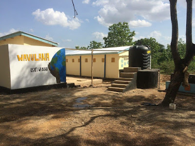
Volunteering on a Water, Sanitation and Hygiene (WASH) project in Rural Tanzania- East Africa

Finished picture of the construction of Two toilet blocks at Kiberege Magereza Primary School: including 18 latrines; 2 disabled toile...